Publications of the Institute of Geophysics, Polish Academy of Sciences
Geophysical Data Bases, Processing and Instrumentation
ISSN-2544-428x eISSN-2299-8020
Series
Publications of the Institute of Geophysics, Polish Academy of Sciences provide original solutions in geophysical measurements, instrumentation, data collections, presentations and analysis.
Recent publications
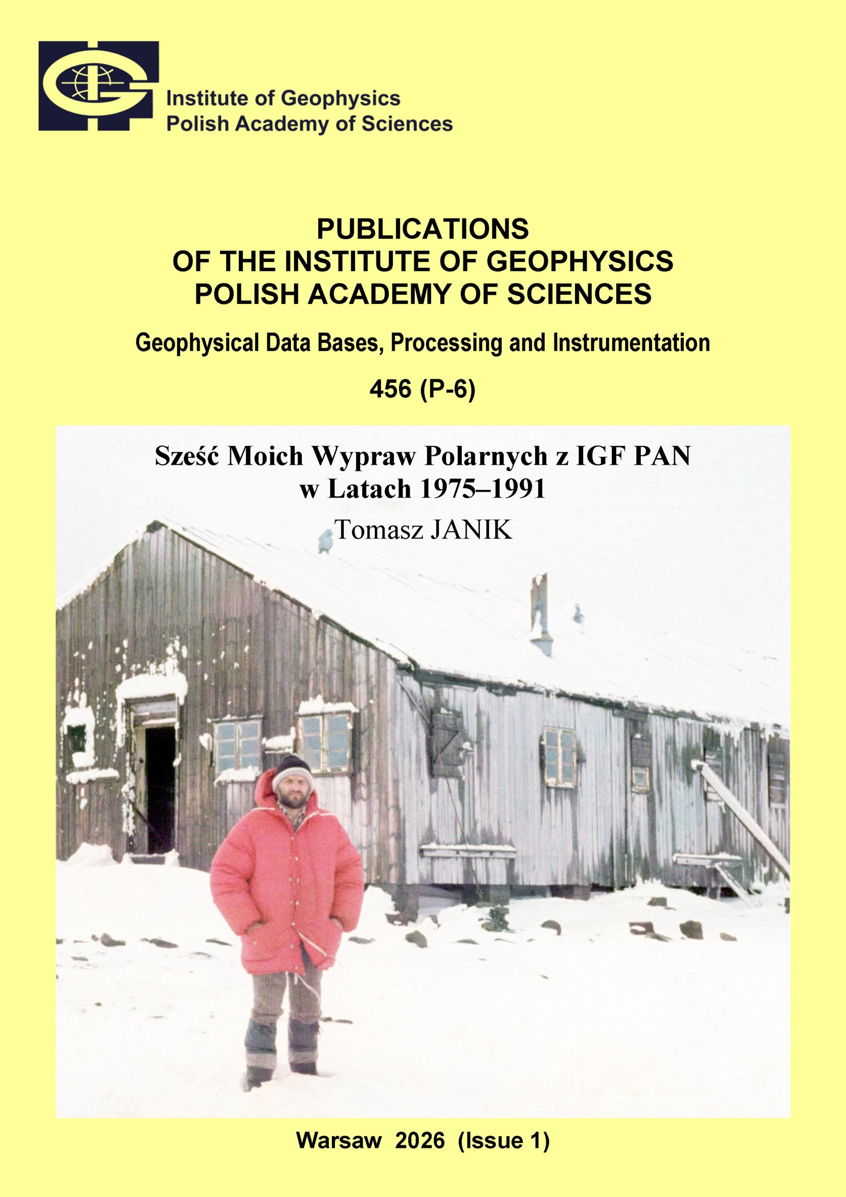
Sześć Moich Wypraw Polarnych z IGF PAN w Latach 1975–1991
Author(s): Janik T.
Volume: 456
Series: P-6
DOI: 10.25171/InstGeoph_PAS_Publs-2026-001
Podczas czterech ekspedycji geodynamicznych do Antarktyki Zachodniej w latach 1979–1991 przeprowadzone były morskie badania sejsmiczne wzdłuż ponad 1000 km szelfu Półwyspu Antarktycznego i Rowu Szetlandów Południowych, od wyspy Elephant do wyspy Adelajdy. Sposób prowadzenia tych badań jest unikalny do dzisiaj, z wielu względów już się nie powtórzy. Zakład Sejsmicznych Badań Litosfery prowadził też badania w Arktyce. W latach 1976–2019 wyruszyło osiem wypraw w rejon Spitsbergenu. Autor opisuje ekspedycję z 1985 roku, jak też wcześniejszą, jeszcze z czasów studenckich (1975), zorganizowaną przez IGF PAN, od której zaczął się jego kontakt z rejonami polarnymi. Wyprawy sejsmiczne dostarczyły bardzo ważnych obserwacji dotyczących północno-zachodniego skraju płyty euroazjatyckiej oraz Grzbietu Śródatlantyckiego na Północnym Atlantyku. Badania przyniosły rozwiązanie szeregu istotnych problemów naukowych, o czym donosiły masowe środki przekazu.
BOOK OF ABSTRACTS. 40th International Polar Symposium – Arctic and Antarctic at the Tipping Point, 4–7 November 2025, Puławy, Poland
Editor(s): Rurek M., Kozioł K., Moskalik M., Czarnecka M.
Volume: 455
Series: P-5
DOI: 10.25171/InstGeoph_PAS_Publs-2025-067
The Polar Symposium is a recurrent conference, typically occurring every two years, dedicated to Arctic and Antarctic topics, with a long tradition dating back to 1972. Since then, these meetings have been an excellent opportunity for integrating the polar community, exchanging experiences, and a discussion between Polish and international polar researchers representing various scientific disciplines. The Polar Symposium is currently co-organised by the Committee of Polar Research, Polish Academy of Sciences, and the Polish Polar Consortium, and until recently it has also been co-organised by the Polar Club of the Polish Geographical Society. Instead, during the 40th International Polar Symposium, a new Polish Polar Club will debut as an independent association, thus continuing the functioning of the Club since 1974.