

- A - Physics of the Earth's Interior
- B - Seismology
-
C - Geomagnetism
C-119, C-118, C-117, C-116, C-115, C-114, C-113, C-112, C-111, C-110, C-109, C-108, C-107, C-106, C-105, C-104, C-103, C-102, C-101, C-100, C-99, C-98, C-97, C-96, C-95, C-94, C-93, C-92, C-91, C-90, C-89, C-88, C-87, C-86, C-85, C-84, C-83, C-82, C-81, C-80, C-79, C-78, C-77, C-76, C-75, C-74, C-73, C-72, C-71, C-70, C-69, C-68, C-67, C-66, C-65, C-64, C-63, C-62, C-61, C-60, C-59, C-58, C-57, C-56, C-55, C-54, C-53, C-52, C-51, C-50, C-49, C-48, C-47, C-46, C-45, C-44, C-43, C-42, C-41, C-40, C-39, C-38, C-37, C-36, C-35, C-33, C-32, C-31, C-30, C-29, C-28, C-27, C-26, C-25, C-24, C-23, C-22, C-21, C-20, C-19, C-18, C-17, C-16, C-15, C-14, C-13, C-12, C-11, C-10, C-9, C-8, C-7, C-6, C-5, C-4, C-3, C-2, C-1
-
D - Physics of the Atmosphere
D-79, D-78, D-77, D-76, D-75, D-74, D-73, D-72, D-71, D-70, D-69, D-68, D-67, D-66, D-65, D-64, D-63, D-62, D-61, D-60, D-59, D-58, D-57, D-56, D-55, D-54, D-53, D-52, D-51, D-50, D-49, D-48, D-47, D-46, D-44, D-45, D-43, D-42, D-41, D-40, D-39, D-38, D-37, D-35, D-34, D-33, D-32, D-31, D-30, D-28, D-27, D-26, D-25, D-24, D-23, D-22, D-21, D-20, D-19, D-18, D-17, D-16, D-15, D-14, D-13, D-12, D-11, D-10, D-9, D-8, D-7, D-6, D-5, D-4, D-3, D-2, D-1
- E - Hydrology
- P - Polar Research
- M - Miscellanea
-
Online First
SVALGEOBASE II: Tectono-thermal Evolution of Svalbard – from Metamorphic and Magmatic Processes to Geothermal Energy. Geological Workshop, Svalbard, 3–9 September 2024
Volume: 452
Series: P-4
DOI: 10.25171/InstGeoph_PAS_Publs-2025-001
We are pleased to present the report from the second edition of the geological workshop SvalGeoBase II, titled “Tectono-thermal evolution of Svalbard – from metamorphic and mag-matic processes to geothermal energy”. Held from September 3 to 9, 2024, in Svalbard, this event continued the legacy of the first edition, SvalGeoBase I, organized in 2013 under the theme “Proterozoic and Lower Palaeozoic basement of Svalbard – state of knowledge and new research perspectives”.
Once again, this ambitious project aimed to host an Arctic scientific conference aboard an expedition vessel. Through multiple landings in the northern Spitsbergen region and Nor-daustlandet, participants had the rare opportunity to engage in field discussions and closely examine rock outcrops that are at the forefront of ongoing scientific debates within the Arctic geology community.
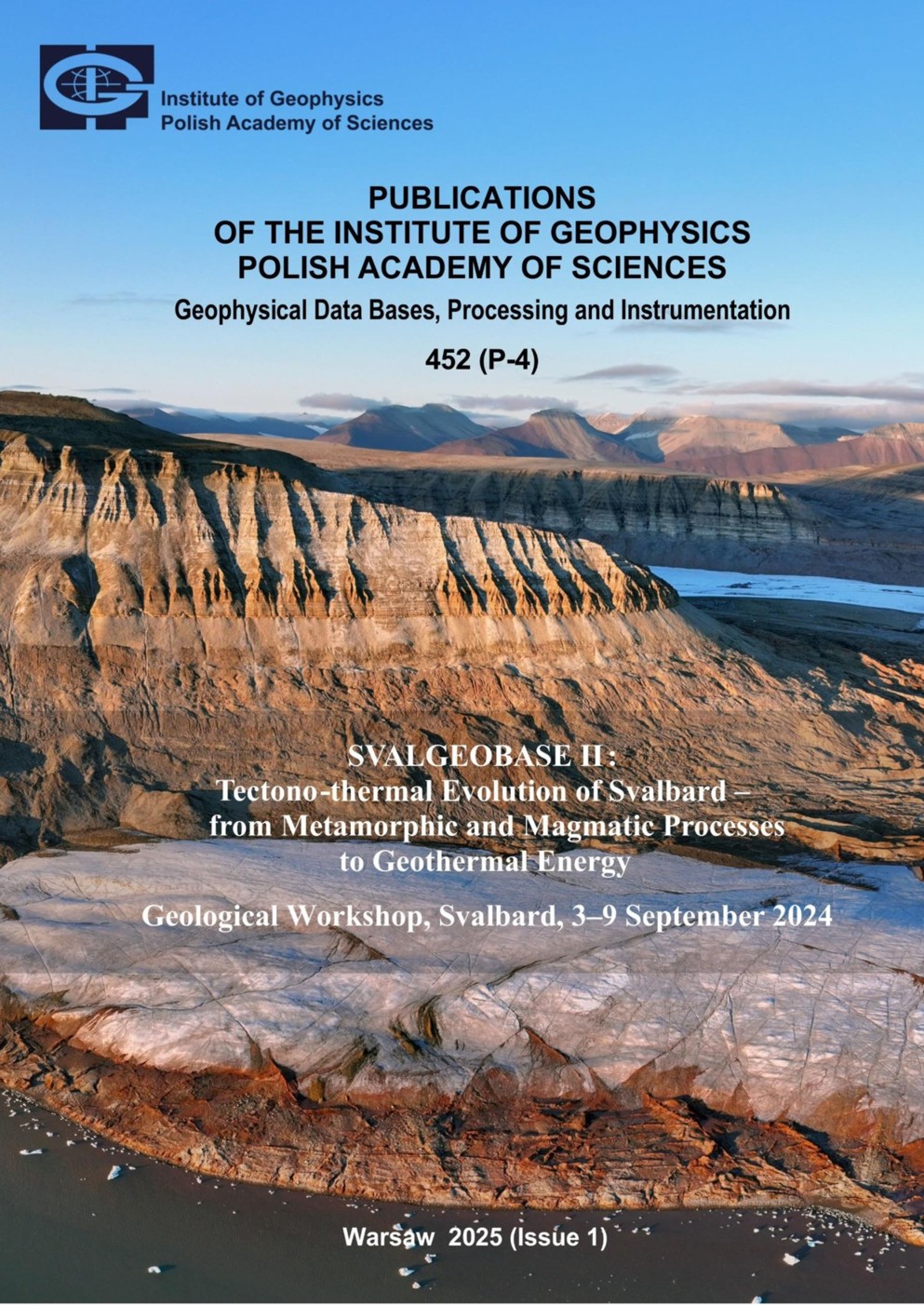
The Svalbard Archipelago once again provided the backdrop for the activities of SvalGeo-Base II. Svalbard’s exceptional geological profile spans rocks ranging from the Early Protero-zoic to the Neogene, offering a detailed record of this Arctic region’s paleogeographic and tectono-thermal evolution. It reflects key processes such as the formation and breakup of the Proterozoic supercontinent Rodinia, the opening of the Iapetus Ocean, the Caledonian collision, and the more recent history tied to the expansion of young oceanic basins in the North Atlantic and the Eurasian Basin.
C O N T E N T S
Acknowledgements, ...3
Preface, ...5
SvalGeoBase Geological Workshop in the Context of Polish Polar Policy – Krzysztof Galos, ...7
SvalGeoBase II Objectives, ...9
Recommendations from the SvalGeoBase II Workshop, ...11
Sailing Route, ...17
Description of Field Excursions – Karsten Piepjohn, Geoffrey Manby, Jarosław Majka, Krzysztof Michalski, Anna Sartell,
Szczepan Bal, and Rafael Kenji Horota, ...19
Abstracts of oral presentations, ...41
The Eurekan West Spitsbergen Fold-and-Thrust Belt on Brøggerhalvøya – Karsten Piepjohn, Kerstin Saalmann, and
Malte Jochmann, ...43
An Alternative Hypothesis for Forming the Eurekan Fold and Thrust Belts of Spitsbergen and North Greenland –
Geoffrey M. Manby and Nikos Lyberis, ...47
Tectonic Evolution of the Wandel Sea Basin, Eastern North Greenland: Insights from Structural Data, Detrital
Zircons Geochronology, Mineralogy, Fluid Inclusions, Vitrinite Reflectance and Conodont Color Alteration Index –
Pierpaolo Guarnieri, Jørgen Bojesen-Koefoed, Nynke Keulen, Jens Konnerup-Madsen, Mette Olivarius,
Jan Audun Rasmussen, and Tonny B. Thomsen, ...53
The North Atlantic Caledonides: from Iapetus Opening to the Scandian Collision and Beyond – Jarosław Majka, ...59
Tectonic Evolution of the Circum-Arctic – Victoria Pease, ...61
A Global Full-plate Model for the Past 2 Billion Years – Yebo Liu, Zheng-Xiang Li, and Sergei Pisarevsky, ...63
Current Paleomagnetic Database of Svalbard – Krzysztof Michalski, Geoffrey Manby, Krzysztof Nejbert, Justyna
Domańska-Siuda, and Szczepan Bal, ...67
Palaeomagnetic Data Obtained from Recent Deglacial Sediments in the Baltic Sea: Modern Analogues May be
the Key to Understanding (Much) Older Records – Ian Snowball, Emilio Herrero-Bervera, and Thomas Andrèn, ...73
Neoproterozoic Diamictites of Polarisbreen Group (Nordauslandet, Svalbard) – Paleo- magnetic and
Petrographic Investigations – Szczepan Bal, Krzysztof Michalski, Geoffrey Manby, Krzysztof Nejbert,
Jarosław Majka, Justyna Domańska-Siuda, Aleksandra Hołda-Michalska, and Jiři Sláma, ...77
Architecture of the Caledonian Fold Belt South of Murchisonfjorden, Western Nordaustlandet – Karsten Piepjohn,
Nikola Koglin, and Frithjof Bense, ...81
The Hadean: Was It Really Hell-like? – Simon A. Wilde, ...85
Geological Constraints on Claims for Earth’s Earliest Life in the Eoarchean of Greenland and Labrador –
Martin Whitehouse, Daniel Dunkley, Monika Kusiak, and Simon Wilde, ...89
Eoarchean Zircons in the Napier Complex, East Antarctica – Monika A. Kusiak, Simon A. Wilde, Martin J. Whitehouse,
Daniel J. Dunkley, Piotr Król, Anthony I.S. Kemp, and Keewook Yi, ...93
Arctic Nanogranitoids and What We Can Learn from Them – Alessia Borghini, Marian Janák, Gautier Nicoli,
Silvio Ferrero, Iwona Klonowska, Jarosław Majka, and Kerstin Gresky, ...99
Can Lamprophyres in LIPS Constrain Upper Mantle Plume Dynamics? – Lars Eivind Augland, Sara Callegaro,
Anders Mattias Lundmark, and Dougal Alexandre Jerram, ...103
A Within-Sill Record of Chlorine Mobilization from Evaporites in Volcanic Basins – Sara Callegaro, Hans Jørgen Kjøll,
Henrik H. Svensen, Frances M. Deegan, Manfredo Capriolo, Olivier Galland, Michael R. Ackerson, and
Thea H. Heimdal, ...107
Diabasodden and Its Suite – the High Arctic Large Igneous Province on Svalbard and Its Type Locality –
Anna M.R. Sartell, ...113
Digital Geology at UNIS: Tools for Supporting Arctic Research, Education, and Expedition Planning – Rafael K. Horota
and Kim Senger, ...119
Appendixes, ...127
Appendix 1. Workshop participants, ...129
Appendix 2. SvalGeoBase II itinerary (day by day), ...131
Appendix 3. Detailed plan of scientific sessions, ...135
Appendix 4: The list of selected projects related to the scientific scope of SvalGeoBase II, ...137
SvalGeoBase Geological Workshop in the Context of Polish Polar Policy
Series: (P-4), 2025, pp.7-8
DOI: 10.25171/InstGeoph_PAS_Publs-2025-002
Download article PDF
Abstract:
Geological research on the Svalbard Archipelago began in the first half of the 19th century and intensified in the second half. Polish researchers joined these studies in the 1930s. In 1934 the first Polish scientific expedition to southern Spitsbergen occurred, involving two outstand-ing Polish polar geologists—Stefan Różycki and Stanisław Siedlecki. One of the key outcomes of this pioneering expedition was the development of a geological map of the then-unexplored and scientifically unknown areas of northwestern Torell Land. To this day, this work remains a cornerstone of Svalbard’s geological literature.
Description of Field Excursions
Series: (P-4), 2025, pp.19-39
DOI: 10.25171/InstGeoph_PAS_Publs-2025-003
Download article PDF
Abstract:
The Eurekan West Spitsbergen Fold-and-Thrust Belt on Brøggerhalvøya
Series: (P-4), 2025, pp.43-46
DOI: 10.25171/InstGeoph_PAS_Publs-2025-004
Download article PDF
Abstract:
The northernmost segment of the West Spitsbergen Fold-and-Thrust Belt on Spitsbergen is exposed on Brøggerhalvøya. There, the trend of the fold belt turns from a NNW-SSE direction between Sørkapp Land and Oscar II Land into an almost E-W direction and is truncated to the west by the eastern boundary fault of the Forlandsundet Graben. The tectonic transport directions and vergences of the folds are toward the northeast and north which is different to the general east-northeast transport directions in the southern continuation of the fold-and-thrust belt in Oscar II Land and south of Isfjorden. The Eurekan deformation on Brøggerhalvøya is dominated by mostly SW-dipping thrusts forming a stack of nine nappes with tectonic transports to the NE and locally to the N. Near the coast of Kongsfjorden and in the western part of Brøggerhalvøya, the lower five nappes (Garwoodtoppen, Kongsfjorden, Kvadehuken, Kjærfjellet, Ny-Ålesund nappes) repeated the post-Caledonian succession and are characterized by flat-and-ramp geometries. In the southwest, the upper part of the nappe-stack consists of four nappes with steeply SW-dipping listric basal thrusts which almost entirely consist of basement rocks (Nielsenfjellet, Bogegga, Trondheimfjella, Moefjellet nappes). The Caledonian basement rocks and the post-Caledonian sedimentary rocks are folded and thrust-faulted together indicating thick-skinned tectonics. The second large-scale structure, characteristic of the Eurekan deformation on Brøggerhalvøya is represented by a kilometre-scale, NE- to N-vergent fold structure which is similar in size to the ENE-vergent folds in the central and southern segments of the West Spitsbergen Fold and-Thrust Belt. This fold structure has been overthrust by the Nielsenfjellet nappe in the central part of the nappe stack.
An Alternative Hypothesis for Forming the Eurekan Fold and Thrust Belts of Spitsbergen and North Greenland
Series: (P-4), 2025, pp.47-52
DOI: 10.25171/InstGeoph_PAS_Publs-2025-005
Download article PDF
Abstract:
The 300 km long, 80 km wide, NNE-NE-directed West Spitsbergen fold and thrust belt and the N-directed Eurekan fold and thrust Belt of North Greenland have much in common with foreland fold and thrust belts. Kinematic reconstructions suggest that before the opening of the Eurasian Basin and the Norwegian–Greenland Sea, Svalbard was linked to North America. The Greenland–Svalbard separation is widely believed to have occurred due to a right-lateral strike-slip along the De Geer Fracture Zone. Many models attribute the formation of both fold belts to dextral transpression along this fracture zone as Svalbard separated from Greenland. In this work, an alternative model explains the origin as the result of Greenland-Svalbard convergence driven by the anticlockwise rotation of Greenland during the opening of the Labrador Sea – Baffin Bay. The characteristics of Svalbard’s fold and thrust belt are outlined, and the supporting evidence is critically assessed, ensuring the validity and reliabil-ity of our findings.
Tectonic Evolution of the Wandel Sea Basin, Eastern North Greenland: Insights from Structural Data, Detrital Zircons Geochronology, Mineralogy, Fluid Inclusions, Vitrinite Reflectance and Conodont Color Alteration Index
Series: (P-4), 2025, pp.53-57
DOI: 10.25171/InstGeoph_PAS_Publs-2025-006
Download article PDF
Abstract:
The Wandel Sea Basin (WSB) in eastern North Greenland is represented by a Late Paleozoic-Mesozoic rock succession unconformably overlying Caledonian tectonic units. In Peary Land major NE-dipping normal faults cut through the basin and separate it in two sectors. In the Whyckoff Land sector towards the North-East, the WSB succession unconformably covers Paleoproterozoic quarzites and is folded and metamorphosed up to lower amphibolite facies. In the Herluf Trolle Land sector of the south-western part, the WSB succession is undeformed, non-mature and unconformably onto Silurian flysch and carbonatic rocks. Cam-panian detrital zircons in the Herlufsholm Strand Formation indicate a possible correlation of this area with the Late Cretaceous volcanism of Kap Washington and constrain the peak met-amorphism to the Maastrichtian-Early Paleocene. The Late Paleocene-Early Eocene Thyra Ø Formation post-dates the folding and the paleostress obtained from fault-slip inversion along major normal faults indicates tectonic inversion with compression followed by strike-slip faulting.
The North Atlantic Caledonides: from Iapetus Opening to the Scandian Collision and Beyond
Series: (P-4), 2025, pp.59-60
DOI: 10.25171/InstGeoph_PAS_Publs-2025-007
Download article PDF
Abstract:
Tectonic Evolution of the Circum-Arctic
Series: (P-4), 2025, pp.61-62
DOI: 10.25171/InstGeoph_PAS_Publs-2025-008
Download article PDF
Abstract:
A Global Full-plate Model for the Past 2 Billion Years
Series: (P-4), 2025, pp.63-65
DOI: 10.25171/InstGeoph_PAS_Publs-2025-009
Download article PDF
Abstract:
Global plate reconstructions with continuously closed topological boundaries, also known as full-plate models, provide a key framework for understanding Earth’s history. These models serve as essential boundary conditions for exploring mantle thermochemical evolution, surface dynamic process, and global climatic changes. Here we present the first global full-plate model for the past 2 billion years
Current Paleomagnetic Database of Svalbard
Series: (P-4), 2025, pp.67-71
DOI: 10.25171/InstGeoph_PAS_Publs-2025-010
Download article PDF
Abstract:
The paleomagnetic investigation of the Svalbard Archipelago can be divided into two distinct groups. Research on the Caledonian basement primarily focuses on testing hypotheses that before final Caledonian amalgamation Svalbard existed as separate crustal blocks – terranes, provinces. Paleomagnetic studies of Late Palaeozoic and younger rocks aim to quantify the paleogeographic position of Svalbard in relation to Baltica (Laurussia). In the latter case, Svalbard is considered as a single lithospheric block, consolidated during the Caledonian orogeny (sensu lato).
Palaeomagnetic Data Obtained from Recent Deglacial Sediments in the Baltic Sea: Modern Analogues May be the Key to Understanding (Much) Older Records
Series: (P-4), 2025, pp.73-76
DOI: 10.25171/InstGeoph_PAS_Publs-2025-011
Download article PDF
Abstract:
Palaeomagnetic data obtained from diamictite have provided evidence of low-latitude Neoproterozoic glaciations at sea-level. Yet, knowledge about the mechanisms that cause these deposits to obtain a natural remanent magnetization (NRM) is incomplete due to the lack of work on relatively recent analogues. We utilise an extensive palaeomagnetic data set from the Baltic Sea Basin (BSB) to illustrate how glacially influenced deposits are prone to significant inclination error, which can lead to false virtual geomagnetic poles and hence palaeolatitudes if a geo-axial dipole (GAD) model is assumed.
Neoproterozoic Diamictites of Polarisbreen Group (Nordauslandet, Svalbard) – Paleomagnetic and Petrographic Investigations
Series: (P-4), 2025, pp.77-79
DOI: 10.25171/InstGeoph_PAS_Publs-2025-012
Download article PDF
Abstract:
Our research unveils new palaeomagnetic and petrographic results from 50 independently oriented samples representing Cryogenian Polarisbreen Group diamictites. These findings, collected in 2022 from the Neoproterozoic sequence of Murchisonfjord, represent a significant advancement in our understanding of the palaeomagnetic record preserved in rocks formed during the Cryogenian glaciations. The sampling includes two sites from the Petrovbreen Member of the Elbobreen Formation and six sites from the Wilsonbreen Formation.
Architecture of the Caledonian Fold Belt South of Murchisonfjorden, Western Nordaustlandet
Series: (P-4), 2025, pp.81-83
DOI: 10.25171/InstGeoph_PAS_Publs-2025-013
Download article PDF
Abstract:
At the south coast of Murchisonfjorden in western Nordaustlandet, a complete sequence of the Neoproterozoic to Lower Paleozoic Murchisonfjorden and Hinlopenstretet supergroups is exposed. The lower part of the succession is composed of km-thick dark grey siltstones and white and red quartzites of the Tonian Frankliniansundet and Celsiusberget groups. The clastic formations are overlain by limestones of the Tonian Roaldtoppen Group and again clastic deposits and diamictites of the Cryogenian/Ediacaran Polarisbreen Group. The youngest part of the sedimentary succession consists of dolostones and limestones of the Cambrian–Ordovician Oslobreen Group. In Nordaustlandet, the Oslobreen Group is represented by the Kapp Sparre Formation at Sparreneset and Krossøya. The entire succession is characterized by very low-grade metamorphic conditions. Sedimentary structures like cross-bedding and ripple marks as well as Neoproterozoic fossils are still well preserved.
The Hadean: Was It Really Hell-like?
Series: (P-4), 2025, pp.85-88
DOI: 10.25171/InstGeoph_PAS_Publs-2025-014
Download article PDF
Abstract:
The term “Hadean” was first introduced by Preston Cloud (1972) for the earliest eon in Earth history. It was derived from the Greek word meaning “God of the Underworld”, but was frequently interpreted to mean that the early Earth was hell-like (cf. Wilde 2022a). This was sup-ported by the view that it was a hot and turbulent place at this time. Implicit in the definition was that it defined the time before preservation of the earliest known rocks. With the discovery of the oldest known magmatic zircon at 4.03 Ga in the Acasta gneiss in the Northwest Territories of Canada (Bowring and Williams 1999), consensus was reached that the Hadean commenced at 4000 Ma (4 Ga), as originally proposed by Plumb and James (1986), although it remained “informal” until its recommendation and adoption in 2012 by the International Sub-commission on Precambrian Stratigraphy and the International Union of Geological Sciences (IUGS).
Geological Constraints on Claims for Earth’s Earliest Life in the Eoarchean of Greenland and Labrador
Series: (P-4), 2025, pp.89-91
DOI: 10.25171/InstGeoph_PAS_Publs-2025-015
Download article PDF
Abstract:
The time at which life on Earth began is one of humankind’s most enduring scientific questions, complicated by the increasing difficulty both in identifying and accurately dating evi-dence of life the further back in time one looks. During the Hadean eon (>4.0 Ga), from which by definition no rock record is preserved, and into the early Archean eon, the inner solar system was subjected to intense meteorite bombardment, with impacts commonly thought to have “frustrated” the development of a persistent biosphere on the Earth. Prior to ca. 3.5 Ga (with the appearance of stromatolites in Pilbara, Australia), there are no preserved body or trace fossils. Instead, evidence for biological activity relies on chemofossil evidence, typically in the form of tiny graphite remnants that record a light carbon isotope signature (δ13C < –20‰) commonly attributed to organic activity. In itself, this evidence is far from unambiguous as there are potential abiotic pathways to isotopically light carbon, but ac-cepting this at face value, two other key factors are required in order to support the veracity and true antiquity of these putative chemofossils. First, it is generally accepted that the host rocks in which the chemofossils are found must represent a near surface environment with access to surface water necessary for metabolism to function. Second, and only if the first criterion is met, in order to claim great antiquity the host rock must be dated unambiguously.
Eoarchean Zircons in the Napier Complex, East Antarctica
Series: (P-4), 2025, pp.93-98
DOI: 10.25171/InstGeoph_PAS_Publs-2025-016
Download article PDF
Abstract:
There is not much evidence as to the nature of the Earth’s earliest crust. The available information has been gleaned mostly from the studies of the oldest crystals of mineral zircon (ZrSiO4), either detrital grains or from oldest known igneous rocks, such as the Acasta orthogneiss in the Slave Province of Canada with an age of 4.03 Ga. One of areas, where Eoarchean rocks ( 4.0–3.6 Ga) occur and protoliths that include some of the oldest crust on Earth occur, is the Napier Complex of Enderby and Kemp Lands in East Antarctica, including Tula Mountains of Enderby Land and Aker Peaks in Kemp Land. The Napier Complex is an Archean craton composed mostly of high-temperature gneisses and granulites. The craton was metamorphosed at least twice, et ca. 2.8 Ga and ca. 2.5 Ga under granulite to ultrahigh-temperature (UHT) granulite condition. The UHT metamorphism had temperature as high as >1100 °C, making these some of the highest temperature metamorphic rocks found in the Earth’s crust.
Arctic Nanogranitoids and What We Can Learn from Them
Series: (P-4), 2025, pp.99-102
DOI: 10.25171/InstGeoph_PAS_Publs-2025-017
Download article PDF
Abstract:
Primary melt inclusions are small droplets of melt trapped in minerals during their growth in the presence of a melt phase. In magmatic rocks melt inclusions have been described since 1858, when Henry Clifton Sorby recognized them in feldspar, pyroxene, and leucite crystals in erupted lavas. Already back then, Sorby was able to observe and recognize under the microscope glassy and crystalized inclusions referring to them as “glass-cavities” and “stone-cavities”, respectively.
Can Lamprophyres in LIPS Constrain Upper Mantle Plume Dynamics?
Series: (P-4), 2025, pp.103-106
DOI: 10.25171/InstGeoph_PAS_Publs-2025-018
Download article PDF
Abstract:
Volatile-rich basanitic melts giving rise to camptonite lamprophyre swarms (Brown 1975) in the Orkney Islands, Northern Scotland, have been precisely dated by mantle xenolithic and autocrystic zircon U-Pb geochronology.
A Within-Sill Record of Chlorine Mobilization from Evaporites in Volcanic Basins
Series: (P-4), 2025, pp.107-111
DOI: 10.25171/InstGeoph_PAS_Publs-2025-019
Download article PDF
Abstract:
Exceptionally voluminous magmatic episodes in the deep geological past, known as Large Igneous Provinces (LIPs), emplaced millions of km3 of magma in the crust and on Earth’s surface in a geologically limited time (<1 Ma), and released vast quantities (Gigatons) of volcanic and thermogenic gases. The outgassing of volatiles was a significant environmental disruptor, leading in some case to global environmental change and biotic crises. LIPs are in fact the only geologic source to rival anthropogenic emissions for volumes and rates of released climate-modifying gases. Reconstructing their degassing histories is thus important as analogue case-studies of present-day and future climate challenges. Studies of LIP volatiles discharge often focus on the two primary climate-modifying volatiles, carbon and sulphur. However, in LIPs whose plumbing systems intruded halogen-rich evaporites, the release of halogens might have been an important environmental and biotic stressor. The reactive halogen species generated during eruptions and upon interaction with halogen-rich sedimentary rocks in volcanic basins could cause acid rains and catalyse ozone layer depletion.
Diabasodden and Its Suite – the High Arctic Large Igneous Province on Svalbard and Its Type Locality
Series: (P-4), 2025, pp.113-117
DOI: 10.25171/InstGeoph_PAS_Publs-2025-020
Download article PDF
Abstract:
During the Cretaceous, the circum-Arctic region was affected by widespread magmatism, known as the High Arctic Large Igneous Province (HALIP). These mainly mafic intrusives and extrusives are found throughout the Queen Elizabeth Islands, northern Greenland, the Alpha-Mendeleev Ridges, the New Siberian Islands, Franz Josef Land, and Svalbard. There have been three proposed pulses, from 124 to 120 Ma, from 99 to 91 Ma, and from 85 to 77 Ma. Generally, the oldest magmatism is tholeiitic, the middle pulse bimodal, and the youngest pulse alkaline. The alkaline pulse is only found in northern Greenland and on the Queen Elizabeth Islands, while the tholeiitic magmatism is found throughout the circum-Arctic, with the exception of Greenland. This large igneous province has been proposed to be related to a Cretaceous Arctic mantle plume, with a center located ca. 200 km west of Ellesmere Island.
The HALIP rocks found throughout the Svalbard archipelago are regionally called the Diabasodden Suite, based on its type locality in central Spitsbergen, the main island of Svalbard. In this contribution, the focus will be on characterizing the Diabasodden Suite based on previously published data.
Digital Geology at UNIS: Tools for Supporting Arctic Research, Education, and Expedition Planning
Series: (P-4), 2025, pp.119-125
DOI: 10.25171/InstGeoph_PAS_Publs-2025-021
Download article PDF
Abstract:
The Arctic is one of Earth’s most frontier areas, with numerous unanswered geoscientific questions. In addition, the Arctic is one of the most dynamic areas of the planet, with recent climate change occurring at much higher rates than in the lower latitudes. This phenomenon, the polar amplification effect, is most evident in Svalbard.
Svalbard is a Norwegian high Arctic archipelago comprising all islands between 74–81°N and 15–35°E, including the largest island Spitsbergen. Geologically Svalbard represents an important (and relatively well-accessible) window to understand the tectono-thermal evolution of the circum-Arctic. There are no indigenous people in Svalbard, but several remote permanent settlements including the “capital” of Longyearbyen. For its high Arctic location, it is easily accessible by regular and affordable flight connections to the Norwegian mainland. It also hosts the University Centre in Svalbard (UNIS), the world’s northernmost educational institution.
UNIS is Norway’s field university and offers field-based courses at bachelor, master, and PhD level in Arctic geology, geophysics, biology, and technology, with research and teaching conducted throughout the year. The large seasonal variation defines the institution’s activity throughout the year. Largely as a consequence of this, UNIS is a leading user of digital geological tools that complement traditional fieldwork and extend the short field season to the entire year.
In this contribution we present two interlinked UNIS-led initiatives that openly provide geoscientific data to a broader audience. Specifically we focus on the photosphere-Atlas, VR Svalbard, and an integrated digital outcrop model database, Svalbox. Specifically we outline how data are acquired, shared, and how they are used in the context of Arctic research, education, and expedition planning. Finally, we showcase a virtual field trip developed specifically for the SvalGeoBase II expedition.